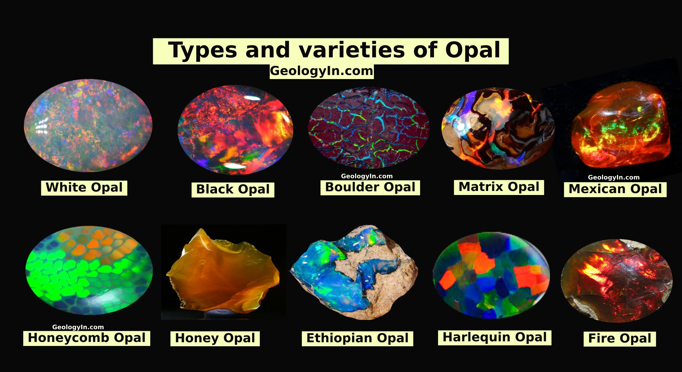
Filling in gaps in the history of earth's magnetic field
 |
Boulder, Colo., The Marcellus Shale is famous as a formation being explored for natural gas resources. That exploration has also offered some insight into an age-old problem: where was the continent of North America 400 million years ago?
In a research partnership between Lehigh University and The Pennsylvania State University, subterranean rock samples have been used to help fill a gap in the history of Earth's magnetic field, and, as a corollary, places some constraints on the position of North America when the Marcellus Formation was deposited.
Geologists use the magnetizations of rocks, acquired during their formation to determine the positions of continents relative to Earth's magnetic field. The magnetic record for the Devonian Period (ending roughly 360 million years ago) is rather patchy. This study shows that the Marcellus Formation (of Devonian age), and others like it may be able to fill in those gaps.
Provided by: Geological Society of America


%20(1).webp)